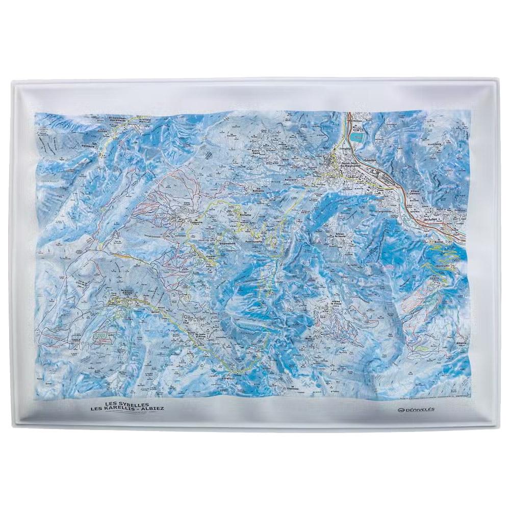
Deniveles - Domaines Les Sybelles - Raised-relief map The Domaines Les Sybelles 3D map by Deniveles offers a detailed view of the ski resorts and landscapes of this region. GBP 46.75 1
Deniveles - Cadre 50x70 cm Black - Raised-relief map Exactly matching the dimensions of the 3D cards manufactured in Auvergne by the Dénivelés company, this frame is made of wood. GBP 27.62 1
Deniveles - Cadre 50x70 cm Brut - Raised-relief map Exactly matching the dimensions of the 3D cards manufactured in Auvergne by the Dénivelés company, this frame is made of wood. GBP 27.62 1
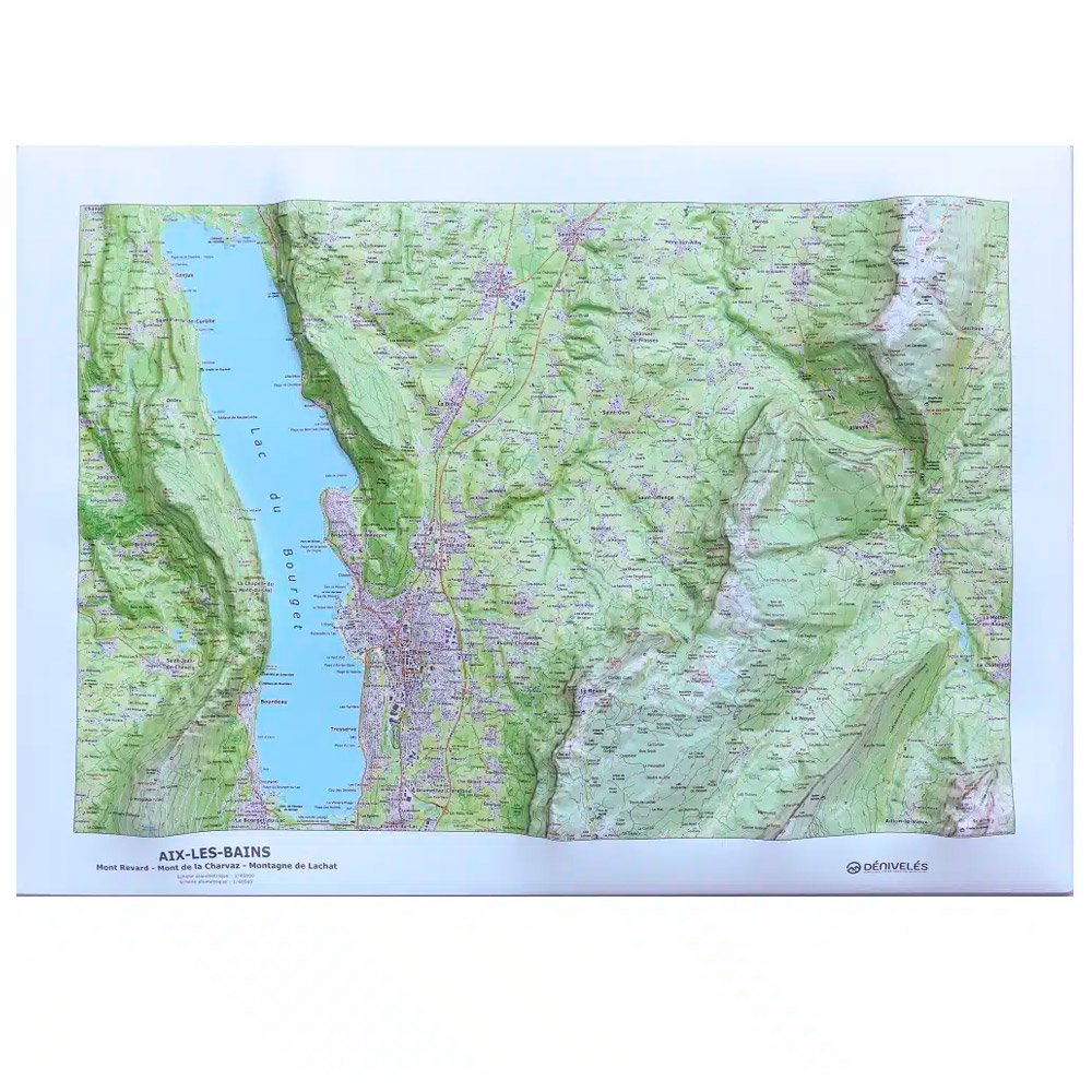
Deniveles - Aix Les Bains - Raised-relief map Made in Auvergne by Dénivelés, this 3D map of Aix Les Bains and the surrounding area lets you immerse yourself in the terrain and plan future escapades. GBP 48.45 1
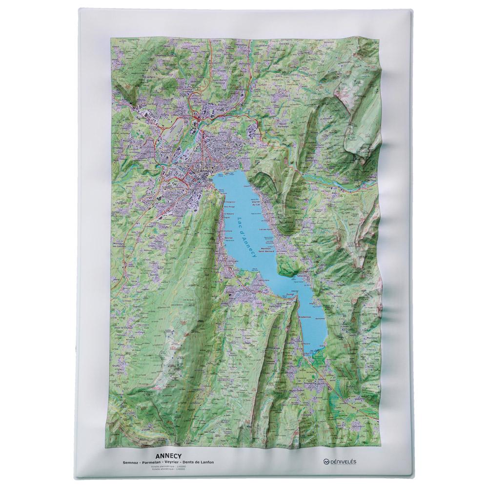
Deniveles - Lac d'Annecy - Raised-relief map Provided by the publishing company Dénivelés, this relief map immerses you in the massifs overlooking Lake Annecy, allowing you to plan your next excursions with great precision. GBP 48.45 1
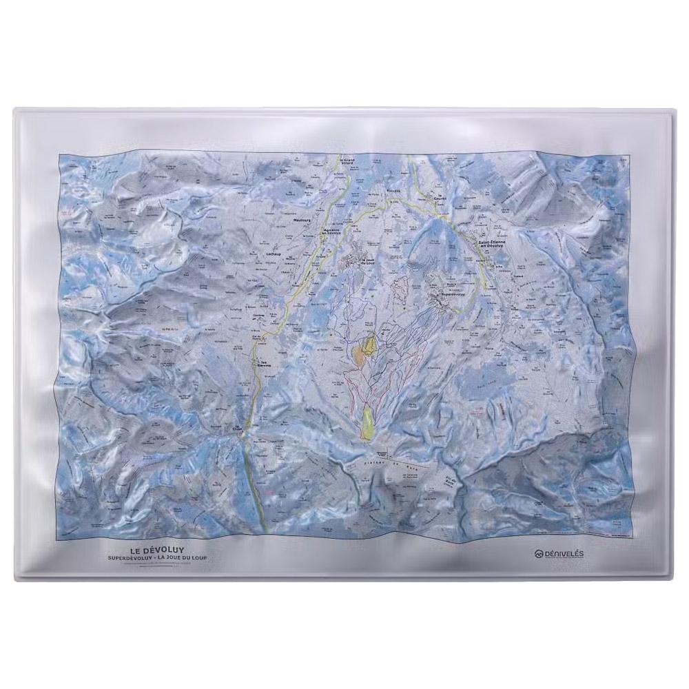
Deniveles - Domaine du Devoluy - Raised-relief map The 3D Domaine du Devoluy map by Deniveles offers a detailed view of the Dévoluy landscape, including peaks, villages and ski resorts, all at a scale of 1:30,000. GBP 46.75 1
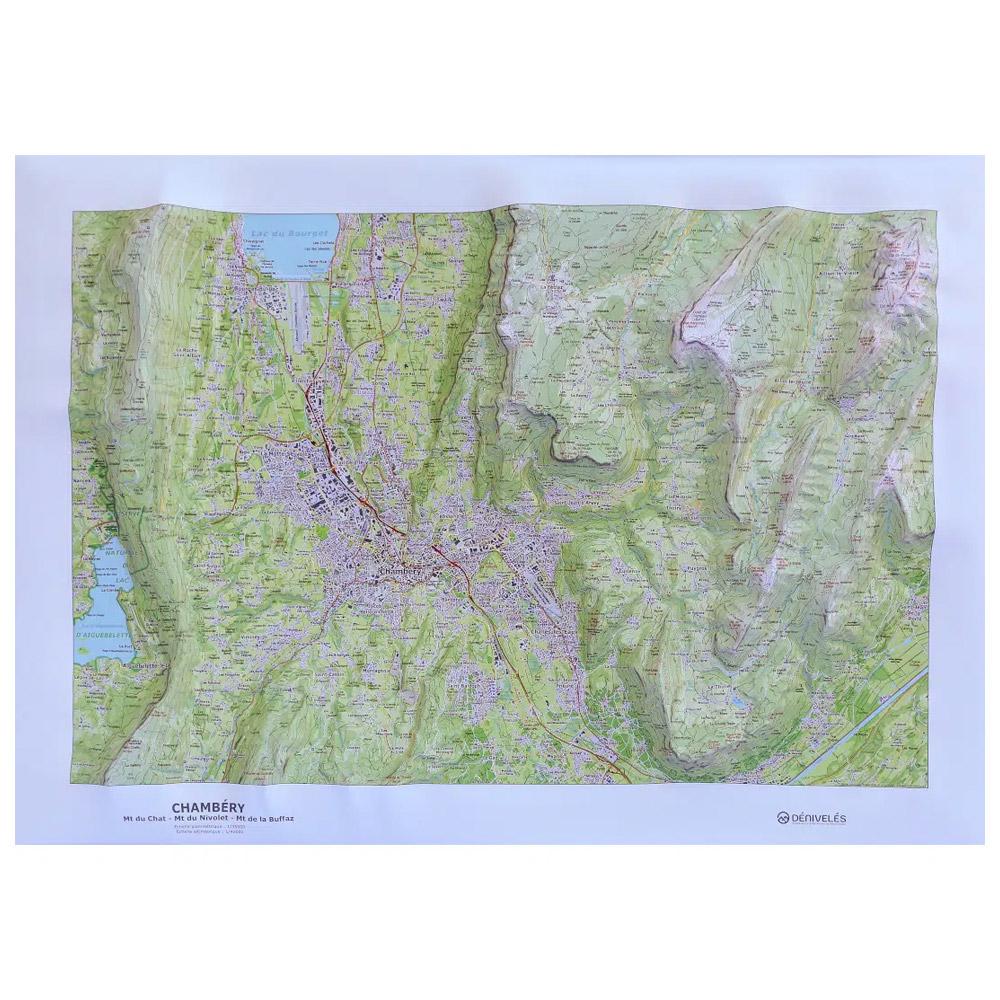
Deniveles - Chambery - Raised-relief map Made by Dénivelés, a company based near Clermont-Ferrand, this 3D map of Chambéry and the surrounding area lets you immerse yourself in the landscape before you get there. GBP 48.45 1
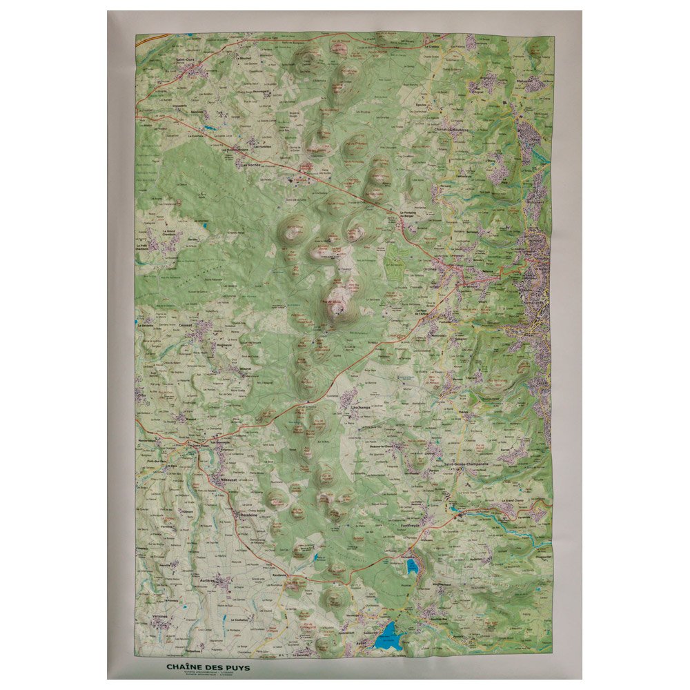
Deniveles - Chaîne Des Puys - Raised-relief map Here is a raised relief map of the Chaîne des Puys made in Auvergne (France) by Dénivelés. It represents in three dimensions the main part of the famous Chaîne des Puys at a 1/35000 scale. GBP 48.45 1