32 resultater (6,09098 sekunder)

Mærke

Butik

Pris (EUR)

Nulstil filter

Produkter
Fra
Butikker

Behind Bars - Lady Unchained - Bog - Octopus Publishing Group - Plusbog.dk

The Classic Cocktail Bible - Spruce - Bog - Octopus Publishing Group - Plusbog.dk

Vegan Chocolate Treats - Emma Hollingsworth - Bog - Octopus Publishing Group - Plusbog.dk

Toblerone Cookbook - Kyle Books - Bog - Octopus Publishing Group - Plusbog.dk

Resourceful Living - Lisa Dawson - Bog - Octopus Publishing Group - Plusbog.dk

The Little Book of Tapas - Rufus Cavendish - Bog - Octopus Publishing Group - Plusbog.dk

Vegan Treats - Emma Hollingsworth - Bog - Octopus Publishing Group - Plusbog.dk

Japanese in 7 - Kimiko Barber - Bog - Octopus Publishing Group - Plusbog.dk

Philip's Navigator Trucker's Britain: Spiral - Philip's Maps - Bog - Octopus Publishing Group - Plusbog.dk

Philip's Navigator Britain Easy Use Format - Philip's Maps - Bog - Octopus Publishing Group - Plusbog.dk

Philip's Navigator Britain: Flexi - Philip's Maps - Bog - Octopus Publishing Group - Plusbog.dk

Philip's Navigator Britain: Spiral - Philip's Maps - Bog - Octopus Publishing Group - Plusbog.dk

In Fine Spirits - Neil Ridley - Bog - Octopus Publishing Group - Plusbog.dk

DKK 190.00
1

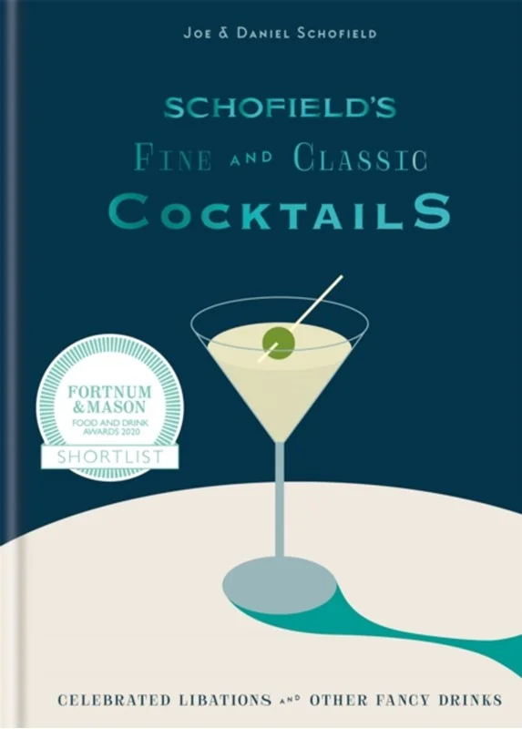
Schofield's Fine and Classic Cocktails - Joe Schofield - Bog - Octopus Publishing Group - Plusbog.dk

Philip's Navigator Wales - Philip's Maps - Bog - Octopus Publishing Group - Plusbog.dk

Philip's Navigator Wales - Philip's Maps - Bog - Octopus Publishing Group - Plusbog.dk

Explore the many attractions of Wales with this easy-to-use road atlas and guide to the top spots from Philip''s, the best-selling road atlas brand. With all you need for travelling in Wales: easy-to-read mapping, superb detail and top travel tips make this the ultimate road trip companion. - Unrivalled level of detail from motorways to country lanes.- Exceptional clarity at a scale of 1.6 miles to 1 inch (1:100,000). - Ideal for explorers: heritage sites, spectacular sights, and the best walks around Snowdonia , the Brecon Beacons , the Pembrokeshire Coast and more. - Tourist attractions and places of interest clearly highlighted, from Caernarfon Castle to St David''s Cathedral .- Indexed town plans for all major centres, including Aberystwyth, Bangor, Cardiff, Holyhead, Llandudno, Llanelli, Merthyr Tydfil, Newport, Newtown, Swansea, and Wrexham.- Packed with hundreds of individually named farms, houses, and hamlets, alongside airports, airfields, stations, ferries, canals, and harbours.- Key to map symbols are clearly indexed and shown in English and Welsh .With its large scale and wealth of travel information, the Navigator atlas is perfect for both leisure and business. Praise for The Philip''s Navigator Series: ''Beats all others.'' - The Daily Telegraph ''The reigning champion of Road Atlases.'' - The Sunday Times ''Scale, accuracy, and clarity are without parallel.'' - Driving Magazine ''No.1 in the UK for clear maps.'' - Independent Research Survey

DKK 120.00
1

2026 Philip’s Road Atlas Britain & Ireland - Philip's Maps - Bog - Octopus Publishing Group - Plusbog.dk

2026 Philip’s Road Atlas Britain & Ireland - Philip's Maps - Bog - Octopus Publishing Group - Plusbog.dk

''Good balance between detail and clarity with excellent town maps'' What Car? ''Perfect for day trips'' The Daily Express PHILIP''S - Market leader and No. 1 in the UK for clear maps 2026 Philip''s Road Atlas of Britain and Ireland is a top-of-the-range, A4-sized, paperback atlas featuring fully updated maps from the Philip''s digital database. Voted Britain''s clearest and most detailed in an independent consumer survey, the mapping is super-clear.* 88 fully indexed and detailed town-centre maps with Low Emission Zones and Ultra Low Emission Zones * T op tips for better and safer driving including how to parallel park * 160 pages of fully updated super-clear road maps * 10 pages of detailed route-planning maps , to help plan your route in advance * Mapping at a scale of 3 miles to 1 inch = 1:200,000 for clarity and ease of use * Major city approach maps with named arterial roads * Clear road mapping showing all of Ireland The maps clearly mark service areas, roundabouts and multi-level junctions, and in rural areas distinguish between roads over and under 4 metres wide. It also includes a 2-page road map of Ireland, 10 pages of route-planning maps, a distance table, 10 large-scale city approach maps with named arterial roads, the latest ULEZ details, and 88 extra-detailed and fully indexed town and city plans. Wherever you are driving in Britain and Ireland, this is the ultimate road trip companion.

DKK 152.00
1

Hamlyn All Colour Cookery: 200 Gluten-Free Recipes - Louise Blair - Bog - Octopus Publishing Group - Plusbog.dk

Hamlyn All Colour Cookery: 200 Gluten-Free Recipes - Louise Blair - Bog - Octopus Publishing Group - Plusbog.dk

200 DELICIOUS AND SIMPLE GLUTEN-FREE RECIPES Gluten-free is the way to be for many of those who suffer from coeliac disease, gluten allergies and even those who simply want to cut wheat from their diet. With over 200 delicious recipes, Hamlyn All Colour: 200 Gluten-Free Recipes showcases how easy life can be when eating gluten-free, and beautiful photographs and clear instructions make this book perfect for every cook at all ability levels. With recipes such as breakfast cereal bars, Thai-style coconut chicken, Victoria sandwich cake, chocolate caramel shortbread and lemon drizzle cake, this book enables home cooks to create healthy meals at home without sacrificing flavour. Check out some of the other titles in the series: Hamlyn All Colour Cookery: 200 Super SoupsHamlyn All Colour Cookery: 200 Halogen Oven RecipesHamlyn All Colour Cookery: 200 Fast Vegetarian RecipesHamlyn All Colour Cookery: 200 Cakes & BakesHamlyn All Colour Cookery: 200 Really Easy RecipesHamlyn All Colour Cookery: 200 Pasta DishesHamlyn All Colour Cookery: 200 Tapas & Spanish DishesHamlyn All Colour Cookery: 200 More Slow Cooker RecipesHamlyn All Colour Cookery: 200 Delicious DessertsHamlyn All Colour Cookery: 200 Veggie FeastsHamlyn All Colour Cookery: 200 One Pot MealsHamlyn All Colour Cookery: 200 Student MealsHamlyn All Colour Cookery: 200 Spiralizer RecipesHamlyn All Colour Cookery: 200 Easy Indian DishesHamlyn All Colour Cookery: 200 CupcakesHamlyn All Colour Cookery: 200 Thai FavouritesHamlyn All Colour Cookery: 200 5:2 Diet RecipesHamlyn All Colour Cookery: 200 Light Slow Cooker RecipesHamlyn All Colour Cookery: 200 Easy Tagines and MoreHamlyn All Colour Cookery: 200 Low Fat DishesHamlyn All Colour Cookery: 200 Cakes & Bakes

DKK 100.00
1

2025 Philip's Road Atlas Britain and Ireland - Philip's Maps - Bog - Octopus Publishing Group - Plusbog.dk

2025 Philip's Road Atlas Britain and Ireland - Philip's Maps - Bog - Octopus Publishing Group - Plusbog.dk

''Good balance between detail and clarity with excellent town maps'' What Car? PHILIP''S - Market leader and No. 1 in the UK for clear maps 2025 Philip''s Road Atlas of Britain and Ireland is a top-of-the-range, A4-sized, paperback atlas featuring fully updated maps from the Philip''s digital database. Voted Britain''s clearest and most detailed in an independent consumer survey, the mapping is super-clear. * Mapping at a scale of 3 miles to 1 inch = 1:200,000 for clarity and ease of use * Top tips for better and safer driving including how to parallel park * 160 pages of fully updated super-clear road maps * 10 pages of detailed route-planning maps , to help plan your route in advance* 88 fully indexed and detailed town-centre maps * Major city approach maps with named arterial roads * Clear road mapping showing all of Ireland This atlas contains 160 pages of road maps covering Britain at 3 miles to 1 inch, with the Western Isles, Orkney and Shetland at smaller scales. The maps clearly mark service areas, roundabouts and multi-level junctions, and in rural areas distinguish between roads over and under 4 metres wide. It also includes a 2-page road map of Ireland, 10 pages of route-planning maps, a distance table, 10 large-scale city approach maps with named arterial roads, the latest ULEZ details, and 88 extra-detailed and fully indexed town and city plans. Wherever you are driving in Britain and Ireland, this is the ultimate road trip companion.

DKK 155.00
1

2025 Philip's Road Atlas Britain and Ireland - Philip's Maps - Bog - Octopus Publishing Group - Plusbog.dk

2025 Philip's Road Atlas Britain and Ireland - Philip's Maps - Bog - Octopus Publishing Group - Plusbog.dk

''Good balance between detail and clarity with excellent town maps'' What Car? PHILIP''S - Market leader and No. 1 in the UK for clear maps 2025 Philip''s Road Atlas of Britain and Ireland is a top-of-the-range, A4-sized, spiral-bound atlas, featuring fully updated maps from the Philip''s digital database. Voted Britain''s clearest and most detailed in an independent consumer survey, the mapping is super-clear.* 160 pages of fully updated super-clear road maps* Top tips for better and safer driving and the easiest way to parallel park * Detailed route-planning maps, to help plan your route in advance* 88 fully indexed and detailed town-centre maps throughout the British Isles* Major city approach maps with named arterial roads including the expanded London ULEZ* Clear road map showing all of Ireland * Mapping at a scale of 3 miles to 1 inch = 1:200,000 for easy use * Handy lie-flat spiral formatThis atlas contains 160 pages of road maps covering Britain at 3 miles to 1 inch, with the Western Isles, Orkney and Shetland at smaller scales. The maps clearly mark service areas, roundabouts and multi-level junctions, and in rural areas distinguish between roads over and under 4 metres wide.It also includes a 2-page road map of Ireland, 10 pages of route-planning maps, a distance table, 10 large-scale city approach maps with named arterial roads, and 88 extra-detailed and fully indexed town and city plans. Wherever you are driving in Britain and Ireland, this is the ultimate road trip guide.

DKK 162.00
1

Philip's Navigator Britain Easy-use format - Philip's Maps - Bog - Octopus Publishing Group - Plusbog.dk

Philip's Navigator Britain Easy-use format - Philip's Maps - Bog - Octopus Publishing Group - Plusbog.dk

Explore Britain with this easy-to-use road atlas from Philip''s , the UK''s best-selling road atlas brand. Easy-to-read mapping, superb extra detail, and a great lie-flat format make this the ultimate British road trip companion. - Exceptional clarity at a scale of 1.8 miles to 1 inch. (Parts of Scotland at 3.6 miles to 1 inch)- Every street in Britain is shown , and over 3000 roads are named.- Ideal for explorers: the atlas details heritage spots, spectacular sights, and the best walks around the Peak District , the Yorkshire Dales , the New Forest , and more. - Tourist attractions and places of interest are clearly highlighted, ranging from Windsor Castle to Stonehenge .- Indexed town plans for all the major regional centres and London''s expanded ULEZ clearly marked,- Packed with hundreds of individually named farms, houses, and hamlets, alongside airports, airfields, stations, ferries, canals, and harbours. - Unrivalled level of detail from motorways to country lanes, with every junction, roundabout and slip road shown.- Key to map symbols are clearly indexed. - Hard-wearing and practical format with spiral binding .With its large scale and wealth of travel information, the atlas is perfect for both touring and business use. Used by emergency services and professional drivers, the Navigator range is best-in-class. Praise for the Philip''s Navigator Series: ''Beats all others.'' - The Daily Telegraph ''The reigning champion of Road Atlases.'' - The Sunday Times ''Scale, accuracy, and clarity are without parallel.'' - Driving Magazine ''No.1 in the UK for clear maps.'' - Independent Research Survey

DKK 192.00
1

2026 Philip’s Road Atlas Britain & Ireland - Philip's Maps - Bog - Octopus Publishing Group - Plusbog.dk

2026 Philip’s Road Atlas Britain & Ireland - Philip's Maps - Bog - Octopus Publishing Group - Plusbog.dk

''Good balance between detail and clarity with excellent town maps'' What Car? ''Perfect for Daytrips'' Daily Express PHILIP''S - Market leader and No. 1 in the UK for clear maps 2026 Philip''s Road Atlas of Britain and Ireland is a top-of-the-range, A4-sized, spiral-bound atlas, featuring fully updated maps from the Philip''s digital database. Voted Britain''s clearest and most detailed in an independent consumer survey, the mapping is super-clear.* SUPER-CLEAR ROAD MAPS - 160 pages of fully updated * TOP TIPS for better and safer driving and the easiest way to parallel park * DETAILED ROUTE-PLANNING maps, to help plan your route in advance* 88 fully indexed and DETAILED TOWN-CENTRE maps throughout the British Isles* Major city approach maps with named arterial roads including the expanded London ULEZ * Clear road map showing all of Ireland * Mapping at a scale of 3 miles to 1 inch = 1:200,000 for easy use * Handy lie-flat spiral formatThis atlas contains 160 pages of road maps covering Britain at 3 miles to 1 inch, with the Western Isles, Orkney and Shetland at smaller scales. The maps clearly mark service areas, roundabouts and multi-level junctions, and in rural areas distinguish between roads over and under 4 metres wide.It also includes a 2-page road map of Ireland, 10 pages of route-planning maps, a distance table, 10 large-scale city approach maps with named arterial roads, and 88 extra-detailed and fully indexed town and city plans. Wherever you are driving in Britain and Ireland, this is the ultimate road trip guide.

DKK 166.00
1

Philip's Navigator Camping and Caravanning Atlas of Britain - Philip's Maps - Bog - Octopus Publishing Group - Plusbog.dk

Philip's Navigator Camping and Caravanning Atlas of Britain - Philip's Maps - Bog - Octopus Publishing Group - Plusbog.dk

THE MUST-HAVE ATLAS OF BRITAIN FOR CAMPING, CARAVANNING AND MOTORHOMES''A map that beats all others'' - The Daily Telegraph ''Scale, accuracy and clarity are without parallel'' - Driving Magazine ''No. 1 in the UK for clear maps'' - Independent research survey The lure of the open road and British countryside has never waned and the appeal of independent exploration has surely grown in recent years. However, the adventurous need practical information about what lies ahead - from bridge heights, widths and weights to places to stop and enjoy. Philip''s Navigator Camping and Caravanning Atlas of Britain is the No. 1 Choice of Road Atlas for the independent travelling motorist and camper van owner. * Scale: 1.5 miles to 1 inch = 1:100,000 (Northern Scotland: 3 miles to 1 inch = 1:200,000) * Over 1,880 approved campsites located, plus essential advice from The Camping and Caravanning Club* Includes essential information for caravanning motorists : 6000 bridge height limits, 1500 bridge weight limits and 260 bridge width limits- No other road atlas of Britain offers this level of detail and clarity - Britain''s best road mapping in a great spiral format - Every street in Britain is marked on the maps- Over 3000 main roads named- 100 indexed town-centre maps plus approaches to 12 major urban areas- Super-detailed 6-page route-planning section- Exceptional road detail , from motorways to country lanes, with every junction, roundabout and slip-road shown- Thousands of individually named farms, houses and hamlets Philip''s Navigator Camping and Caravanning Atlas of Britain includes a special feature by The Friendly Club, which is packed with essential camping and caravanning information.

DKK 261.00
1

Philip's Navigator Scotland - Philip's Maps - Bog - Octopus Publishing Group - Plusbog.dk

Philip's Navigator Scotland - Philip's Maps - Bog - Octopus Publishing Group - Plusbog.dk

Philip''s Navigator Scotland is the UK''s most trusted atlas of Scotland. The Navigator brand is famous for the UK''s clearest mapping and superb extra detail - essential for the motorist, whether for business or pleasure - and all with a fully updated section on the best Scotland has to offer. '' A map that beats all others. '' - The Daily Telegraph '' Scale, accuracy and clarity are without parallel. '' - Driving Magazine '' No.1 in the UK for clear maps. '' - Independent research survey - Exceptional clarity at a scale of 1.5 miles to 1 inch = 1:100,000 (3 miles to 1 inch = 1:200,000 for Northern Scotland) - No other road atlas of Scotland can provide this level of detail and touring information - Invaluable ''Best Places to Visit'' section , including heritage spots, spectacular sights and the best walks, including the Southern Upland, West Highland, Great Glen and Speyside Ways - Key town-centre maps fully indexed for easy navigation - Exceptional road detail , from motorways to country lanes, with every junction, roundabout and slip-road shown - Packed with hundreds of individually named farms, houses and hamlets, alongside all the key heritage and cultural sites - Hard-wearing and practical A4 format with spiral binding Navigator Scotland offers so much more than a mere road map: hundreds of individually named farms, houses and hamlets, airports, airfields, stations, ferries, canals, harbours, tourist information centres, and a wide range of places of interest ranging from castles to chapels. Every element is clearly indexed for easy use and includes indexed town plans of all the major regional centres. Added to all that is a guide to Scotland''s many leisure facilities and listings of a wide variety of activities from abseiling to yachting.The atlas is perfect for touring with its large scale and wealth of travel information. The exceptional detail also makes the atlas ideal for local business use.

DKK 117.00
1

2026 Philip's Big Road Atlas of Britain & Ireland - Philip's Maps - Bog - Octopus Publishing Group - Plusbog.dk

2026 Philip's Big Road Atlas of Britain & Ireland - Philip's Maps - Bog - Octopus Publishing Group - Plusbog.dk

''Good balance between detail and clarity with excellent town maps'' What Car? PHILIP''S is No. 1 in the UK for clear maps. The latest 2026 Philip''s Big Road Atlas of Britain and Ireland, in a supersize large format, has fully updated maps from the Philip''s digital database alongside all the detail and information needed for successful travel. * Low Emission and Ultra Low Emission Zones clearly marked on town plans * Top driving tips for safety and skill including parallel parking * The best scenic routes, natural features and landscape highlighted for enhanced travelling * Practical '' more to view per page '' A3 size * Main scale of maps: 3 miles to 1 inch = 1:200,000 for ease of use* Route-planning section for the easiest navigation* 64 fully indexed town and city plans * City approach maps with named roads for the best access * Clear road map showing all of Ireland 2026 Philip''s Big Road Atlas of Britain and Ireland contains 96 pages of road maps covering Britain at 3 miles to 1 inch (Scottish Highlands and Western Isles at 4 miles to 1 inch, Orkney and Shetland at 5.25 miles to 1 inch). The maps clearly mark service areas, roundabouts and multi-level junctions for easy navigation, and in rural areas distinguish between roads over and under 4 metres wide, to help wide vehicles. There are extra-detailed town plans for easy navigation with all counties marked for clarity. The atlas also includes a 2-page road map of Ireland, route-planning maps, a distance table, and 12 large-scale city approach maps with named arterial roads and the expanded ULEZ clearly outlined for London.Wherever you are driving in Britain or Ireland, this is the ultimate road companion.

DKK 152.00
1

Philip's Navigator Scotland - Philip's Maps - Bog - Octopus Publishing Group - Plusbog.dk

Philip's Navigator Scotland - Philip's Maps - Bog - Octopus Publishing Group - Plusbog.dk

Philip''s Navigator Scotland is the UK''s best-selling atlas of Scotland. The Navigator brand is famous for the UK''s clearest mapping and superb extra detail - essential for the motorist, whether for business or pleasure - and all with a fully updated section on the best Scotland has to offer. '' A map that beats all others. '' - The Daily Telegraph '' Scale, accuracy and clarity are without parallel. '' - Driving Magazine '' No.1 in the UK for clear maps. '' - Independent research survey - Exceptional clarity at a scale of 1.5 miles to 1 inch = 1:100,000 (3 miles to 1 inch = 1:200,000 for Northern Scotland) - No other road atlas of Scotland can provide this level of detail and touring information - Invaluable ''Best Places to Visit'' section , including heritage spots, spectacular sights and the best walks, including the Southern Upland, West Highland, Great Glen and Speyside Ways - Key town-centre maps fully indexed for easy navigation - Exceptional road detail , from motorways to country lanes, with every junction, roundabout and slip-road shown - Packed with hundreds of individually named farms, houses and hamlets, alongside all the key heritage and cultural sites - Hard-wearing and practical A4 format with spiral binding Navigator Scotland offers so much more than a mere road map: hundreds of individually named farms, houses and hamlets, airports, airfields, stations, ferries, canals, harbours, tourist information centres, and a wide range of places of interest ranging from castles to chapels. Every element is clearly indexed for easy use and includes indexed town plans of all the major regional centres. Added to all that is a guide to Scotland''s many leisure facilities and listings of a wide variety of activities from abseiling to yachting.The atlas is perfect for touring with its large scale and wealth of travel information. The exceptional detail also makes the atlas ideal for local business use.
DKK 119.00
1